
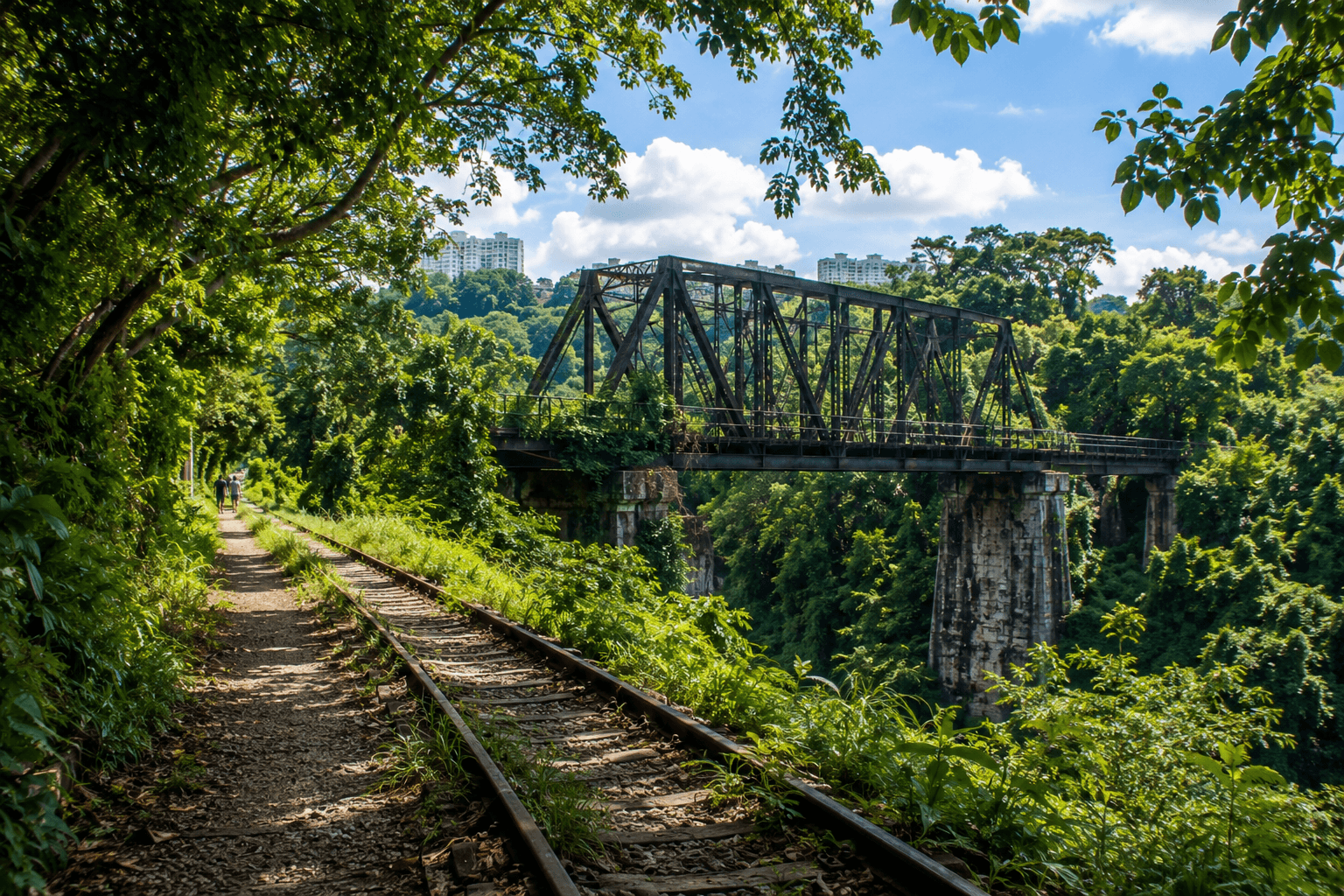
Singapore has more to offer than skyscrapers, shopping streets, and busy attractions. The Rail Corridor Singapore brings together lush greenery, railway history, and scenic trails for a completely different way to explore the city.
The former railway route now forms a 24-kilometre green corridor between the former Tanjong Pagar Railway Station and Woodlands, linking neighbourhoods, heritage sites, and pockets of nature along the way.
But you don't have to walk all 24 kilometres to experience it. The corridor changes quite noticeably as you move north, from more developed and accessible sections to rustic trails, forested areas, and old railway landmarks. You can choose a short walk around Bukit Timah, spend more time exploring the Central section, or take on a longer stretch if you're up for it.
There are also a few things to know before you go. A section of Rail Corridor South is currently closed for trail improvement works, and the northern and central stretches have different trail surfaces and access points.
This guide breaks down which section to walk, what you can see along the way, the railway history behind the route, and what to know before setting out.
What Makes the Rail Corridor Singapore Special?
The Rail Corridor Singapore follows the former KTM railway route through Singapore, creating a 24-kilometre green spine between Tanjong Pagar and Woodlands. Today, it brings together walking routes, railway heritage, and natural habitats in a way that feels quite different from a typical city park.
From Former Railway Line to a 24-km Green Corridor
The route occupies land that was once part of the Keretapi Tanah Melayu (KTM) railway line, which connected Singapore with the Malay Peninsula.
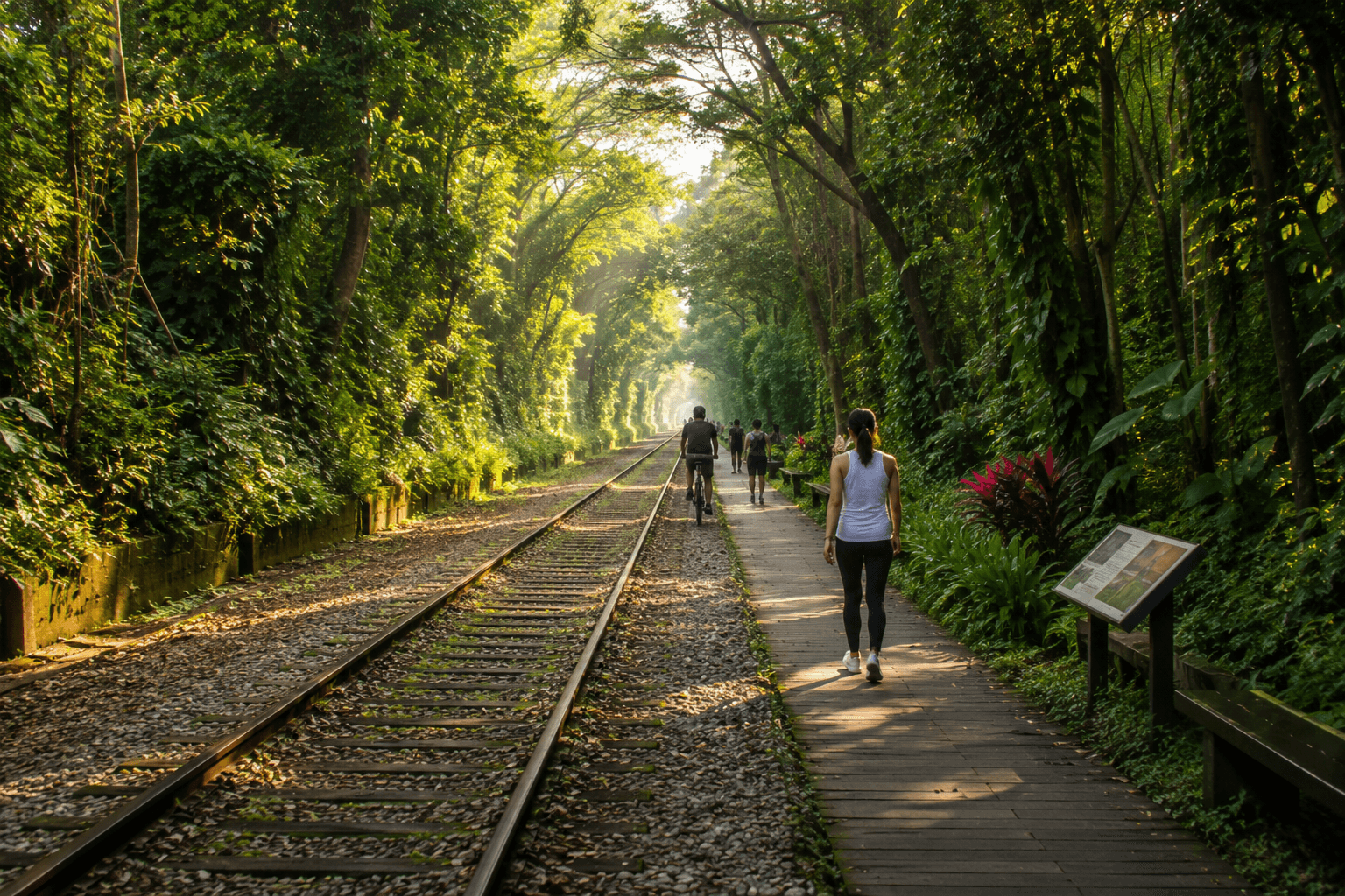
After the railway land was returned to Singapore in 2011, the route was retained as a continuous green space rather than being completely redeveloped. Its railway past remains visible in several places, while the corridor now supports walking, cycling, recreation, and wildlife movement.
Where the Rail Corridor Runs Today
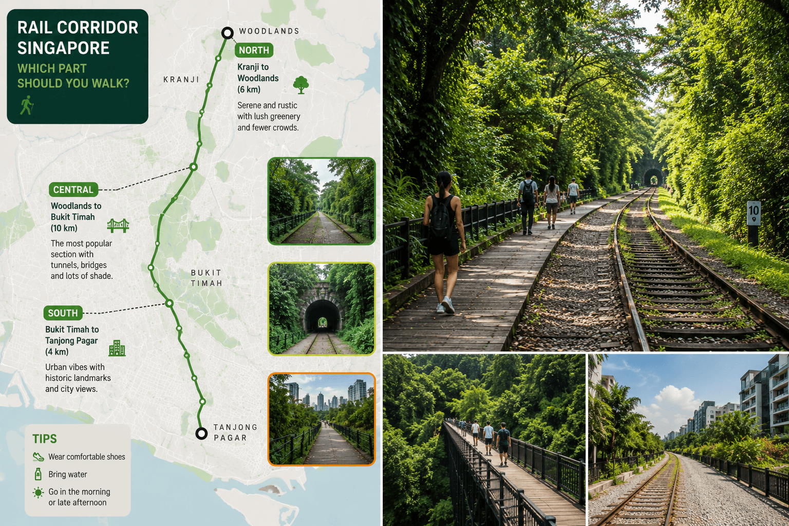
The 24-kilometre route stretches from the former Tanjong Pagar Railway Station in the south to Woodlands in the north. For visitors, it helps to think of it in three broad sections:
- Rail Corridor South: The more urban section, with a stronger connection to surrounding neighbourhoods.
- Rail Corridor Central: The heritage-rich stretch around Bukit Timah Railway Station, with restored railway features and greener surroundings.
- Rail Corridor North: The more rustic section, where grass and gravel trails pass through a wider variety of natural habitats.
What Makes the Trail Different From Singapore's Usual Park Routes?
The biggest difference is that the railway route itself shapes the experience. You're following an old transport corridor rather than a purpose-built park trail, so historic structures and traces of the former railway appear alongside greenery.
The trail surface also changes as you travel north:
- South: Mainly porous bound aggregate paths
- Central: A mix of improved paths and more natural sections
- North: Mainly grass and gravel trails
That gradual transition from a more urban setting to a naturalistic trail is part of what gives the Corridor its character.
The History of Singapore's Rail Corridor
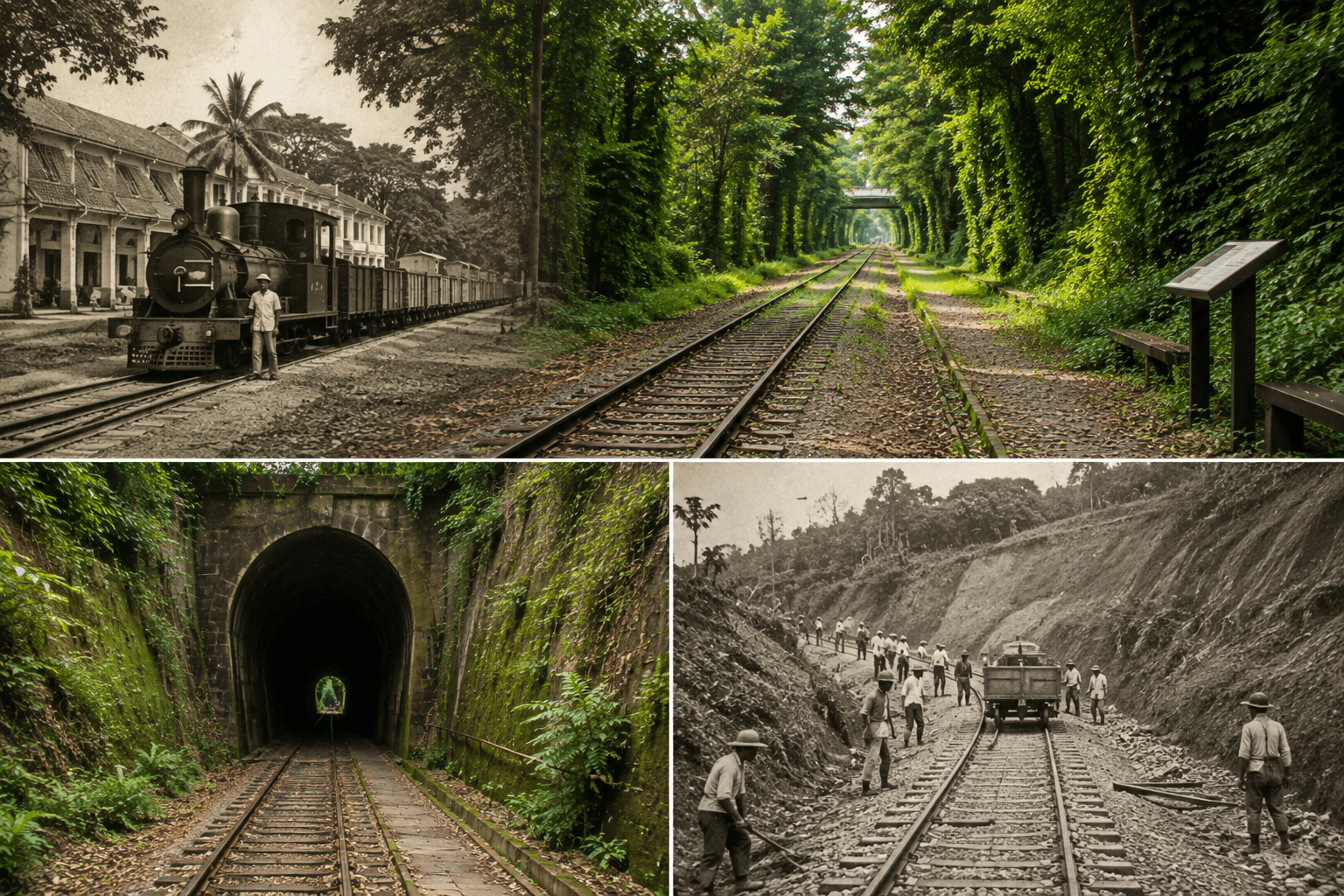
The Corridor's story begins long before it became a walking route. For decades, the railway was an important connection between Singapore and the Malay Peninsula, carrying people and goods through what are now some of Singapore's busiest and greenest areas.
The Former KTM Railway Between Singapore and Malaya
The railway was operated by Keretapi Tanah Melayu (KTM) and connected Singapore with the wider railway network in Malaya. A major milestone came in 1923, when the Johor–Singapore Causeway opened.
This created a direct railway connection between Singapore and Johor, allowing trains to transport passengers and goods across the Causeway. For much of the 20th century, the railway remained part of everyday life in Singapore.
It served long-distance passengers, commuters, and freight traffic until its eventual closure.
Why the Railway Land Returned to Singapore
The railway's Singapore operations came to an end on 30 June 2011, when the last KTM train departed from Tanjong Pagar Railway Station. The following day, the railway land was returned to Singapore under an agreement between Singapore and Malaysia.
The former railway reserve then became the subject of discussions about how the land should be used. Rather than treating it simply as another development site, Singapore chose to retain much of its green character and railway heritage, eventually shaping the corridor into a public recreational route.
How the Railway Legacy Remains Visible Today
Although trains no longer run here, the railway's influence hasn't disappeared. The route's history is preserved through conserved structures, railway remnants, and interpretive features placed along the corridor. These elements help explain how the land was once used without turning the entire trail into a museum.
The result is a walking route where the history is embedded in the landscape itself. As you explore different sections later in the journey, you'll encounter these reminders in their original setting rather than as isolated historical displays.
Which Part of the Rail Corridor Singapore Should You Walk?
You don't need to tackle the entire Rail to enjoy it. The route changes considerably from south to north, so the best section depends on whether you want an easier urban walk, railway heritage, or a more natural trail experience.
Rail Corridor South: The More Urban Section
The southern end feels the least like a remote trail. It passes through developed parts of Singapore, with roads, residential areas, and commercial districts never far away. This makes Rail Corridor South useful if you want a shorter walk without committing to a long hike.
It can work well for:
- A quick morning walk
- Combining the trail with nearby neighbourhoods
- Visitors who prefer more accessible terrain
- A shorter introduction to the former railway route
Important: The South section currently has closures and diversions because of ongoing works, so check the latest access conditions before planning a walk here.
Rail Corridor Central: The Heritage-Rich Stretch
For a first visit, Rail Corridor Central is arguably the most rewarding section if your main interest is the railway story. This is where the trail becomes more closely associated with Singapore's railway heritage, while the surroundings also become noticeably greener.
The Central section is a good choice if you want to combine:
- A walk through a greener setting
- Railway history
- Conserved railway structures
- Access to the Bukit Timah Railway Station area
- A route that doesn't require a full-day hike
If you only have a few hours and want the section with the strongest combination of history and scenery, this is the one I'd prioritise.
Rail Corridor North: The Rustic, Nature-Filled Section
Head further north, and the character changes again. Rail Corridor North is more rustic, with sections of grass and gravel rather than the more finished surfaces found elsewhere. This is the better choice if your priority is space, greenery, and a less urban walking experience.
Expect:
- Longer stretches without major buildings beside the trail
- Grass and gravel underfoot
- More natural vegetation
- Connections towards Singapore's northern green areas
- A trail experience that feels more like a countryside walk than a city park
The North section is particularly appealing if you've already explored the heritage-focused Central stretch and want to see a completely different side of the corridor.
How to Choose a Section Based on Time and Scenery
Rather than choosing purely by location, use your available time and interests:
| If You Have... | Choose... | Why |
|---|---|---|
| 1–2 hours | South or a short Central walk | Easier to keep the route short |
| 2–3 hours | Central | Good balance of heritage and greenery |
| 3+ hours | Central + North | Lets you experience a bigger change in scenery |
| Nature is your priority | North | More rustic surroundings and natural trail surfaces |
| Railway history is your priority | Central | Strongest concentration of railway-related heritage |
| You want an easy introduction | Central | Enough to experience the corridor without attempting a long-distance walk |
You also don't have to think of the Rail Corridor as a single start-to-finish hike. Picking one section and exploring it properly is often a better experience than trying to cover as much distance as possible.
For most first-time visitors, Central is the safest all-round choice, while North is the stronger pick if you specifically want a longer, greener, and more rustic walk.
Rail Corridor Singapore Highlights You Shouldn't Miss
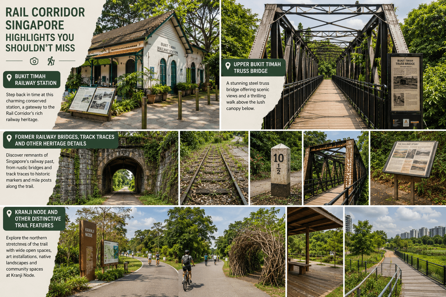
The best parts of the Rail Corridor are not spread evenly along the route. If you want to see the railway heritage that gives the trail its identity, focus your attention on the Central section and the northern stretch around Hillview. These are the places where former railway structures, restored buildings, and newer trail features come together.
Bukit Timah Railway Station
The Bukit Timah Railway Station is one of the most important stops along the route. Built in 1932, the conserved station is now a heritage gallery where visitors can see details that belonged to the original railway operation.
Inside the station, look for:
- The restored ticketing booth
- Original track-switching levers
- A replica of the signals diagram
- The former Signal Room, which can be viewed from the entrance
- Railway-related displays explaining the station and corridor's history
The station is part of a larger community node that also includes the Railway Staff Quarters, Kampung Garden, Herb and Spice Garden, an event lawn, and a sheltered yard with public toilets.
The Herb and Spice Garden is a particularly nice addition because it connects the old railway site with everyday Singaporean food culture. Plants include laksa leaf, Siamese ginger, and cili padi.
Upper Bukit Timah Truss Bridge
The Upper Bukit Timah Truss Bridge is one of the most recognisable railway structures along the Rail Corridor. The steel bridge dates to 1932 and is notable for its Pratt truss design.
Rather than simply walking past it, take a moment to look at the structure itself. The exposed steel framework makes it easy to understand how the bridge once supported railway traffic.
The surrounding area also gives you access to several useful trail connections:
- Rail Mall is close to the bridge, making it a practical place to stop for food or drinks.
- A landscaped access route connects the bridge area with the Corridor.
- The nearby 9 Mile Platform provides another small reminder of the railway's former infrastructure.
- The Hillview Bridge connects the Rail Corridor with Hillview MRT and includes railway-track elements in its design.
Former Railway Bridges, Track Traces and Other Heritage Details
The Corridor's railway history is not limited to the two most famous landmarks. As you walk, keep an eye out for smaller details that show where the railway once ran.
In the Central section, these include:
- Hindhede Bridge, a steel-girder railway structure
- Singapore Quarry Bridge
- Bukit Timah Bridge
- Repaired and conserved brick or concrete stairways that once formed part of the railway landscape
- Rail markings embedded into the trail near Bukit Timah Railway Station, showing the position of the former tracks
These details are easy to overlook if you're concentrating only on the main trail. The embedded rail markings near the station are especially useful because they let you see exactly where the railway tracks once sat.
Kranji Node and Other Distinctive Trail Features
Further north, the experience changes from railway heritage to a more open and nature-focused trail. The Kranji Node, located opposite Kranji MRT Station, is a useful starting point for exploring Rail Corridor North.
It includes:
- A 250-metre rustic nature trail
- A 2,000-square-metre events field
- Direct connections into the wider Rail Corridor
- Barrier-free access from Kranji MRT
Another distinctive feature is the lookout deck near Hillview Bridge. From here, you can look across towards Dairy Farm Nature Park and Bukit Timah Nature Reserve, giving you a much broader view than you get from the trail itself.
If you're walking this section, the lookout is worth adding to your route rather than treating it as a simple point-to-point walk. It gives you a chance to stop, take in the surrounding landscape, and see how closely the trail sits alongside Singapore's larger nature areas.
Rail Corridor Singapore for Nature and Wildlife
The Rail Corridor is not a wildlife park, but its greenery and quieter stretches can still offer opportunities to spot urban wildlife. If you walk slowly and pay attention, especially in the Central and North sections, you may see birds, butterflies, squirrels, and other small animals among the vegetation.
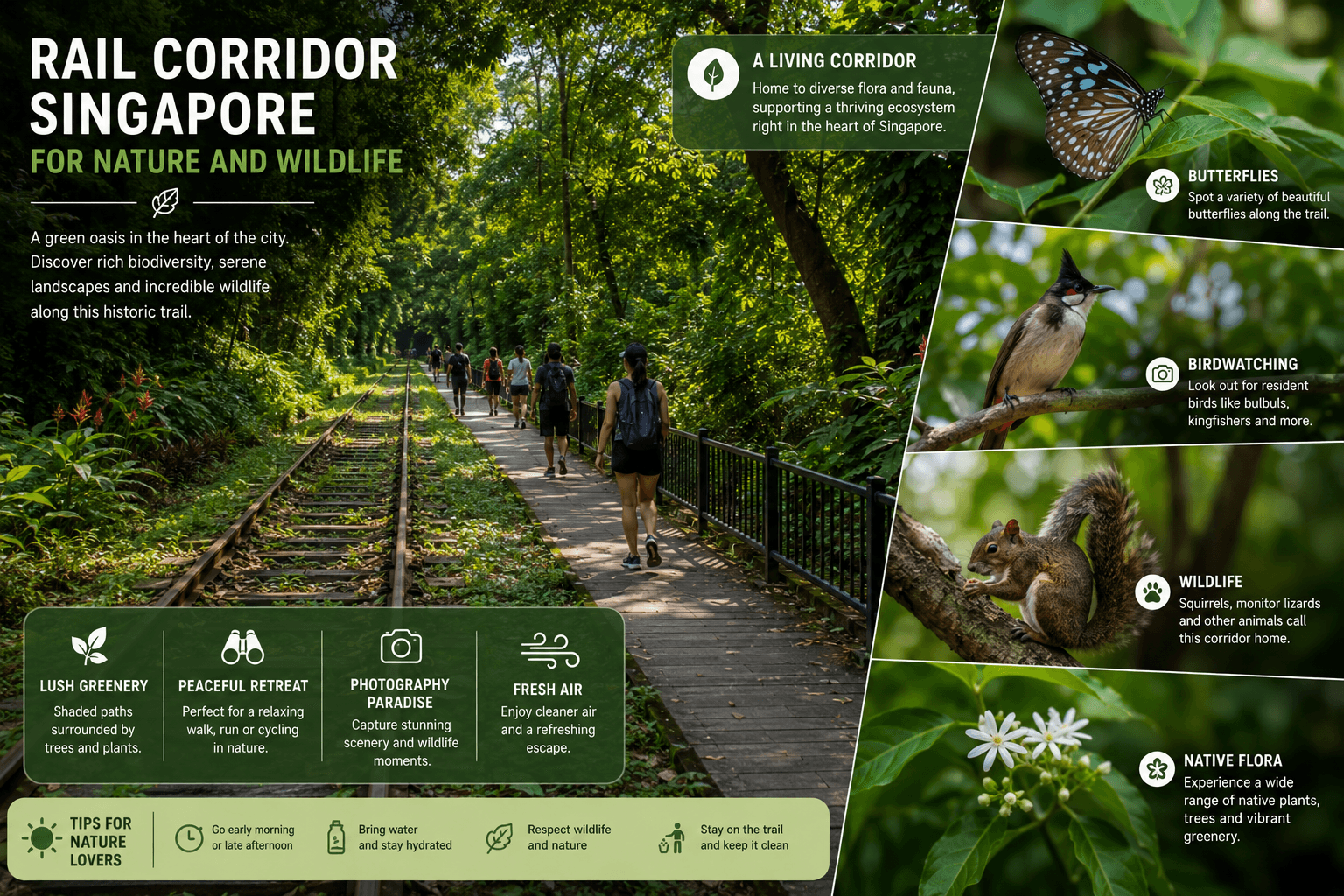
The surrounding waterways and forested areas also make these sections feel more natural than much of Singapore's built-up landscape.
Forest, Grassland and Wetland Habitats Along the Corridor
The vegetation changes depending on where you walk. Around Bukit Timah, the corridor sits close to some of Singapore's most important forested areas, while further north the landscape opens into grassland and wetland habitats.
Some of the notable natural environments connected to the corridor include:
- Bukit Timah Nature Reserve: one of Singapore's most significant remaining areas of primary rainforest.
- Dairy Farm Nature Park: connected to the Rail Corridor around Hillview and the Central section.
- Singapore Quarry: a former granite quarry that has been transformed into a freshwater wetland habitat.
- Kranji Marshes: a major freshwater marshland area accessible from the northern part of the wider corridor network.
This variety means a walk along the Corridor can feel very different from one section to another. You may start beside residential buildings and, not far later, find yourself walking beneath dense vegetation or beside a much quieter natural landscape.
How the Corridor Connects Singapore's Major Green Spaces
One of the most important things about the Rail Corridor is its connectivity. The route forms part of a wider network linking green spaces that would otherwise be separated by roads and development. Around the Central section, the corridor sits close to Bukit Timah Nature Reserve, Dairy Farm Nature Park, and Hindhede Nature Park.
Further north, the landscape connects towards Kranji Marshes and other northern habitats. For visitors, this means you can combine the Corridor with nearby nature areas instead of treating it as an isolated trail. For wildlife, the continuous vegetation provides a route through an otherwise highly developed city.
Wildlife and Birdwatching Opportunities
You don't need to be an experienced birdwatcher to notice wildlife here. The quieter sections of the corridor can produce sightings of birds, butterflies, squirrels, monitor lizards, and other small animals.
Depending on the section and time of day, keep an eye out for:
- Oriental Pied Hornbills
- White-throated Kingfishers
- Greater Racket-tailed Drongos
- Plantain squirrels
- Long-tailed macaques
- Water monitors
- Butterflies and other insects around flowering plants
The areas around Singapore Quarry and Dairy Farm can be particularly interesting for nature observation because of the combination of vegetation and water. For birdwatching, early morning is generally the better choice. The trail is quieter, temperatures are lower, and birds are more active.
Why the Rail Corridor Matters Beyond Recreation
The green space has value beyond giving people somewhere to walk. The former railway reserve provides habitat and movement routes for wildlife, helping connect isolated patches of greenery.
This is particularly important in a dense city where roads and buildings can break natural habitats into smaller areas. That is why it is interesting even if you aren't there specifically for hiking. The railway route that once connected Singapore by train now also helps connect parts of its natural landscape.
When walking through these areas, keep to the designated trail, avoid feeding wildlife, and give animals plenty of space. If you spot something interesting, watching quietly from a distance is far better than approaching it for a photograph.
Planning a Rail Corridor Singapore Walk
A Corridor walk is much easier to enjoy when you choose your section first rather than arriving without a plan. The route covers very different terrain, and your starting point can determine whether you're walking on a maintained path, gravel, grass, or a more urban stretch.
How to Access the Trail
There isn't one single entrance to it. You can join it at multiple points, depending on the section you want to explore.
Some practical access points include:
| Area | Useful For | Nearby Transport / Landmark |
|---|---|---|
| Jalan Kilang Barat | Southern section access | Redhill / nearby bus connections |
| Bukit Timah Railway Station | Central heritage walk | Beauty World / King Albert Park area |
| Hillview | Central-to-North exploration | Hillview MRT |
| Kranji Node | Northern section | Kranji MRT |
| Woodlands | Northern end | Woodlands area |
If your main goal is the railway heritage, Bukit Timah Railway Station is one of the easiest places to build a route around. For a more nature-focused outing, start further north.
How Much Time to Allow for Different Sections
Don't plan your visit purely by kilometres. Stops for photographs, heritage sites, and nearby nature areas can make a short distance take much longer.
| Time Available | Best Approach |
|---|---|
| 1–2 hours | Choose one short section and explore it at a relaxed pace |
| 2–3 hours | Walk a substantial part of Central or North |
| Half day | Combine Central highlights with nearby nature areas |
| Most of a day | Attempt a much longer point-to-point route with transport planned at the end |
For a first visit, 2–3 hours is a comfortable target. It gives you enough time to walk, stop at key points, and take photographs without turning the outing into an endurance hike.
Half-Day Combinations
If you have a few hours, you can combine a Rail Corridor walk with other nearby attractions to create a more varied half-day outing. A few options include:
- Rail Corridor + Bukit Timah Nature Reserve: Combine a heritage-focused walk with a rainforest experience.
- Rail Corridor + Singapore Botanic Gardens: Pair the trail with a relaxed visit to one of Singapore's major gardens.
- Rail Corridor + Bukit Timah Railway Station: Focus on railway history before continuing through the surrounding trail.
- Rail Corridor + Beauty World: Finish your walk with food, cafés, or a break around the Beauty World area.
What to Wear and Bring
Your packing depends on the section, but a few things are particularly useful:
- Comfortable walking shoes with a good grip
- Lightweight, breathable clothing
- Water, especially for longer Central or North walks
- Sun protection, such as a cap and sunscreen
- Insect repellent
- A small towel or tissues
- Phone or camera for photographs
- A small power bank for longer walks
If rain is possible, bring a lightweight rain jacket. Some sections can become muddy or slippery after heavy rainfall, so avoid footwear with completely smooth soles.
Walking, Cycling and Trail Etiquette
The Rail Corridor is shared by walkers, cyclists, and other trail users, so don't treat it like a private hiking path. Keep these points in mind:
- Keep left when walking where the trail is shared.
- Move aside when stopping for photographs.
- Cyclists should slow down around pedestrians and in tighter sections.
- Keep dogs under control and follow pet-related rules.
- Do not leave food or litter along the route.
- Stay on designated paths instead of cutting through vegetation.
- Don't climb on, damage, or remove railway heritage features.
- Give wildlife plenty of space, particularly macaques and monitor lizards.
Most importantly, don't assume that every section offers the same walking conditions. Check the current route status before setting out, particularly if you're planning to use the southern section.
Rail Corridor Singapore: Important Things to Know Before You Go
A little preparation matters here because it is not one uniform park trail. Access, trail surfaces, and facilities change from section to section, and some parts are currently affected by works.
Current South Section Closure and Alternative Routes
The Rail Corridor South has an active closure linked to works around the Henderson Road and Spooner Road area. This means you should not plan a continuous walk through the affected section without checking the latest route information first.
If you're mainly interested in the southern end, check which access points are open on the day you visit and be prepared to use the available diversion. For a first visit, the easiest approach is to choose Central or North instead of building your entire itinerary around the currently affected South section.
Why You Should Leave the Corridor Before Dark
The Corridor is not designed for night hiking. Once daylight fades, visibility drops quickly on the greener and more secluded stretches, particularly where vegetation is dense or the trail surface is less developed.
Plan to finish your walk while there is still good daylight. This is especially important if you're exploring Rail Corridor North, where longer stretches can feel considerably more isolated than the urban sections.
What to Know About Rain, Uneven Surfaces and Trail Conditions
Singapore's weather can change quickly, and rainfall can make some parts of the corridor considerably less comfortable.
After rain, you may encounter:
- Wet and slippery surfaces
- Muddy patches on grass or gravel sections
- Puddles and standing water
- Fallen leaves and branches
- Reduced visibility during heavy rain
The Central and North sections are particularly important to approach with proper footwear, as they have more natural trail surfaces than the developed southern stretches. A good pair of walking shoes with grip is much more useful here than casual flat shoes.
Toilets, Accessibility, Parking and Other Useful Facilities
Facilities are not evenly distributed along the entire route, so don't expect to find a toilet or café every few minutes.
Useful places to remember include:
| Facility / Stop | What It Offers |
|---|---|
| Bukit Timah Railway Station | Public toilets and heritage facilities |
| Rail Mall | Food, drinks, and other conveniences near the Central section |
| Kranji Node | Public facilities and access to the northern trail |
| Hillview area | MRT access, food, and other nearby amenities |
For a longer walk, use a toilet and refill your water before heading into a quieter section rather than assuming another facility will be nearby. If you're driving, parking directly along the trail is limited.
Public transport is generally more practical, especially when doing a one-way walk where your finishing point is different from your starting point.
Finally, check the current access conditions before leaving home. The Corridor is still evolving, and temporary works or diversions can affect how you reach particular sections.
Final Thoughts
You don't have to be a serious hiker to enjoy the Rail Corridor Singapore. Pick a section that matches your time, walk at your own pace, and let the route introduce you to a side of Singapore that feels very different from its usual city attractions.
For a first visit, Rail Corridor Central is the easiest choice if you want to see railway heritage, greenery, and some of the corridor's most recognisable features in one outing. If you'd rather have a quieter walk surrounded by more natural scenery, head towards Rail Corridor North.
Whichever section you choose, don't rush through it just to cover more distance. Stop at the old railway structures, look around the surrounding greenery, and enjoy the fact that a route once used by trains is now one of Singapore's most distinctive walking trails.